Now Reading: The Candy Cliffs of Utah: A Hidden Geological Marvel in the Desert
-
01
The Candy Cliffs of Utah: A Hidden Geological Marvel in the Desert
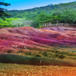
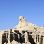
Tucked away in the high desert plateaus of southern Utah, just a short drive from St. George, lies one of the American Southwest’s most captivating geological treasures: the Candy Cliffs, also known as Yant Flat. While Zion and Bryce Canyon often dominate the headlines, this lesser-known expanse of swirling sandstone is no less enchanting. With radiant bands of red, orange, and white Navajo sandstone sweeping across the terrain in surreal patterns, the Candy Cliffs are nature’s own abstract art installation.
The landscape here is an ancient one—formed over millions of years through a powerful combination of sedimentation, uplift, and erosion. The colorful formations are part of the Navajo Sandstone formation, deposited during the Jurassic period when this region was home to massive windblown sand dunes. Over time, the weight of overlying materials compressed these dunes into rock, and iron oxidation imparted the vivid palette that makes the cliffs so visually arresting today.
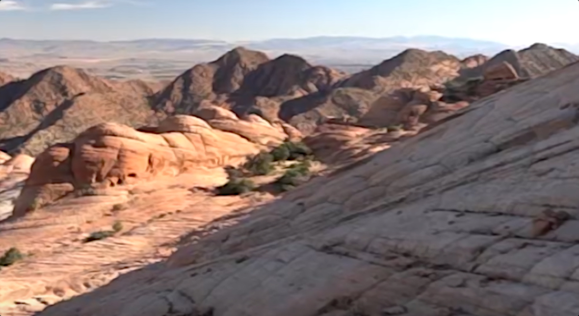
Unlike more vertically imposing formations in Utah’s national parks, the Candy Cliffs offer a more intimate geological experience. The rolling slickrock and undulating mounds invite visitors to walk directly on the stone canvas, where each step reveals a new swirl, dip, or dome. The surface seems almost fluid, like a frozen wave, where lines and colors blend with hypnotic rhythm. It’s a place that feels sculpted more by artistry than erosion.
The cliffs are a dream for hikers, photographers, and curious geologists. The journey begins on a sandy trail through juniper-dotted scrubland, deceptively modest in its approach. But after about 1.5 miles, the forest gives way to an open vista of brilliant rock that seems to rise and fold into the sky. This is the edge of the Yant Flat plateau, and the beginning of the Candy Cliffs proper.
The experience is less about a destination and more about exploration. There is no single “main viewpoint.” Instead, the cliffs encourage meandering. One minute, you’re peering down into a steep chute etched into the rock; the next, you’re perched atop a candy-striped dome with panoramic views stretching to Zion National Park in the east and the Pine Valley Mountains in the north. For those who venture farther, the so-called “Yellow Top” offers a particularly striking vantage point.
The Candy Cliffs also reflect the growing appreciation for public lands that exist outside the well-known national parks. They are part of Dixie National Forest, a vast expanse of protected land that encompasses a stunning variety of ecosystems, from alpine forests to desert plateaus. This diversity makes the region a haven for geology lovers, bird watchers, and outdoor adventurers alike.
From a geological perspective, the Candy Cliffs are nothing short of extraordinary. At first glance, their beauty seems almost too whimsical to be natural—ribbons of red, orange, white, and pink stone swirling across the landscape like taffy. But these surreal patterns are the result of millions of years of natural processes shaping one of Earth’s most iconic sedimentary formations: Navajo Sandstone.
To truly appreciate the Candy Cliffs beyond their surface beauty, it helps to understand the unique geological forces at work—not just in their formation, but in their ongoing evolution. These cliffs are more than colorful stone; they are part of a dynamic geological narrative that has unfolded over hundreds of millions of years.
One of the most fascinating aspects of the area is its mineralogical complexity. The vivid colors aren’t just painted on—they’re chemically embedded within the rock. The red and orange hues come primarily from hematite (Fe₂O₃), while pinks and purples are often the result of goethite or manganese oxides. These iron-bearing minerals were deposited by groundwater percolating through the porous Navajo Sandstone, reacting with oxygen in the rock to form rust-like pigments. The distribution of these colors often follows ancient fluid flow pathways, allowing geologists to trace the movement of water through rock long after it has disappeared.
Additionally, the cliff faces display exquisite examples of differential weathering. This occurs when some layers or parts of the rock are more resistant to erosion than others, due to variations in cementation, grain size, or mineral content. Over time, wind and water exploit these weaknesses, etching dramatic patterns and giving rise to the domed, lumpy topography that defines the landscape today.
Another subtle but scientifically rich feature is the presence of soft-sediment deformation in localized areas. These are slight warps and folds in the sandstone that occurred while it was still partially unconsolidated, likely triggered by ancient seismic activity or dune collapse. These features act like frozen echoes of events that occurred millions of years ago, hinting at the volatile conditions of early desert environments.
Moreover, the Candy Cliffs are part of the broader Colorado Plateau, a geologic region that has remained relatively undeformed compared to the surrounding terrain. This stability allowed ancient rock layers to be uplifted as a relatively intact block, preserving entire stratigraphic sequences like a massive natural archive. Yet, despite this structural integrity, the area is adjacent to the Basin and Range Province, where crustal extension has pulled the landscape apart, creating fractures and exposing even deeper geological layers to erosion.
Lastly, for those who study paleoclimate, the Navajo Sandstone serves as an invaluable proxy. Its grain sorting, mineral content, and dune structures offer clues to the Jurassic climate system—revealing long cycles of aridity, monsoonal patterns, and even the influence of ancient sea incursions. Fossilized ripple marks and interdunal lake deposits found elsewhere in the formation help round out a picture of a world long vanished, yet still legible in stone.


Related Posts
Stay Informed With the Latest & Most Important News
Previous Post
Next Post


Advertisement